Categories
Orienteering

OpenOrienteeringMap and MapRunF

OpenOrienteeringMap, a website for creating a PDF street orienteering map of anywhere in the world based on OpenStreetMap data, has seen a massive upsurge of use since various countries starting locking down their populations during the Covid-19 crisis. Suddenly, many people have found their exercise limited to around their home area, and, if they aren’t lucky enough to live on a “proper” orienteering map, OOM is a great way of getting a simple map quickly – with blue plaques and (for the UK) postboxes pulled in with a single click as potential control sites.

At the same time, there have been a number of initiatives to combine the basic orienteering concept of navigating with a map between points, with the use of GPS receivers on the smartphones most of us carry, and their increasingly high-resolution screens, to virtually “punch” a control by being in the correct location, and carrying the map on the phone.

MapRunF is one such project – with an Android and iPhone app. Courses can be created on the phone itself using Google Maps aerial imagery, or .ocd format maps and courses loaded in from OCAD or Mapper. But if you want the authentic orienteering experience without needing to do “proper” mapping, OpenOrienteeringMap now offers two buttons to easy the import into MapRunF.

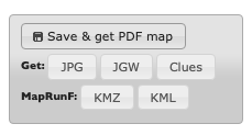
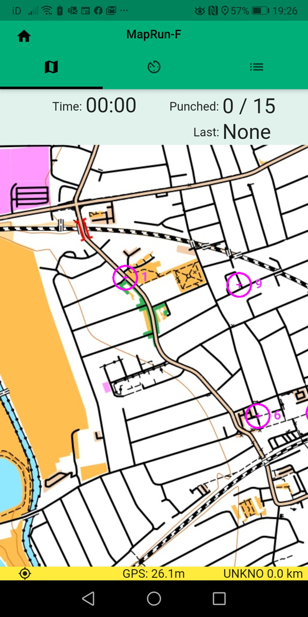
Once you’ve saved your map and course, you can click on the KMZ and KML buttons to download a map and courses file respectably. You can then upload these to Check Sites, note down the ID number, and load it into your phone running MapRun F. Straight away, you have your orienteering map and courses, ready to run!

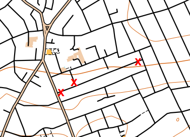
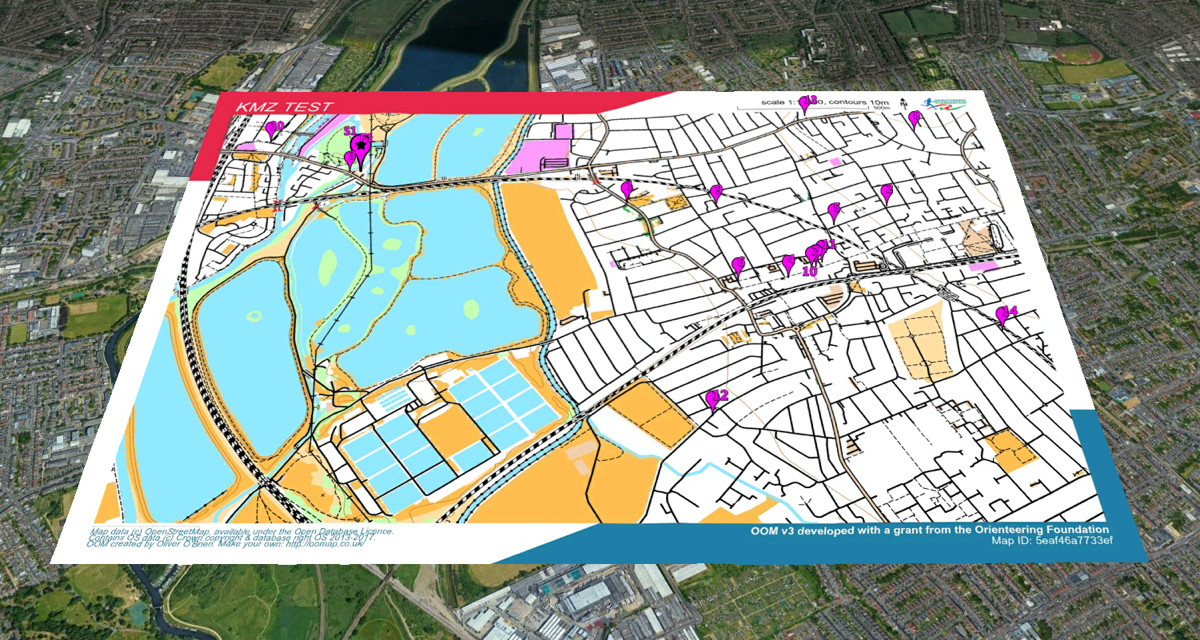
The KMZ map file does not include the courses or start/finish marker, as these are contained within the KML course file. However, it does contain any crossing point “bridge” symbols or do-not-cross “X” markers that you added.

The KMZ and KML files also work in Google Earth:

Try OpenOrienteeringMap – the UK and Ireland editions update daily from OpenStreetMap, while the Global edition updates once or twice a year – but you can create a map at any time! Look out also for a daily updating Australia version soon.

Categories
Orienteering

OOMap 2.2 – Closed Route Crosses

crosses2

OpenOrienteeringMap 2.2 has been released, with a significant new feature addition – closed route crosses. These allow you to manually mark routes as out of bounds, for example along roads or paths which are private and locked at either end. The crosses are red “X”s, they are added singly, using the same dialog box for adding controls.

It is recommended that you places a little distance away from junctions, so that it is clear which road/path is being marked as closed,(and because the crosses will be sized slightly differently in the PDF that is created). You cannot edit or move existing red crosses, as they do not have an edit button in the control descriptions list, but you can delete all the red crosses you have added with the “Delete Xs” button at the top.

crosses1

I’ve also updated the styles slightly:

  • leisure=garden now included, shown as yellow (open ground). Previously it was shown as olive green (out of bounds) on Pseud-O or as white (not mapped) on Street-O.
  • Waterways in tunnels (such as canals or underground rivers) are no longer shown.
  • landuse=greenfield and landuse=brownfield no longer shown, as these are just legal designations.
  • landuse=construction and landuse=landfill now shown with light pink overlay rather than vertical black lines (Pseud-O) or white (Street-O).
  • On Pseud-O, fences (barrier=fence) are now shown with the fence symbol, rather than the wall symbol.
  • On Pseud-O, sports pitches no longer automatically have a fence shown around them.

The styles are open source, in Mapnik XML format, and can be found here on GitHub.

Why not try out the new feature now!

The OpenOrienteeringMap service is giftware. If it’s useful for you, it helps you run a successful event, or saves you time mapping, please buy me something on my gift-list or buy a print. Or buy yourself something through my Amazon store link. Gifts will encourage further development and offset the costs of hosting the site. The styles are open source (see link above) and you are encouraged to adapt them!