Categories
Mashups

Modelling and Mashing

I’m coming up to the end of my current role at UCL, starting a new role (same department, same lab) on Thursday 1 October. Over the next couple of weeks, I’m going to outline the work I’ve been doing over the last year. The projects I’ll blog about are:

The core project:
1. Spatial interaction model for school to university flow

Core visualisations:
2. Education atlas
3. School catchments
4. HE profiler

Incidental visualisations:
5. Manchester map
6. HEFCE funding map

Preview of my next project:
7. Censusgiv prototype

Other work:
8. A Facebook application for names
9. The Splintdev blogs

Categories
London

M:F Ratio as a measure of a City’s Cycling Friendliness

Okansas links to an interesting study in the Scientific American which relates the cycling friendliness of a city to the male-female ratio of the cyclists in it – the theory being that men are more likely to brave a motor-friendly place while women need more encouragement.

I counted 19 men and 17 women on bikes on my commute into work today, although this was after the normal London commuting time, and a significant part of the commute was not on roads. I suspect that there is more of a male bias on the busier roads and during the rush hour.

Categories
Uncategorized

Social Network Visualisation

I think this sort of thing is amazing:

nexus20090923

It’s a visualisation of my contacts on the Facebook social networking website, generated by the Nexus Friend Grapher. The black dots are people I know, and the lines connect mutual friends together. Using a Hooke’s Law type of mechanics, where the black dots are masses and the lines are springs, produces this sort of graph, where clumps form.

I think this sort of “personal social footprint” is as powerful a way to show your identity and uniqueness as conventional demographics. Every person’s graph will have a unique shape and pattern.

It’s also an interesting conceptual idea to find the “shortest line” from one side of the graph to the other. This in effect discovers the “best way” that two completely unrelated friends could get to know each other, just by meeting other friends of mine along the way, without me needing to be around to do the introductions.

By the way, forming the biggest clump, on the right, are the orienteers. The top part roughly corresponds to SLOW – not as tightly connected as it’s not a student club. The middle part is JOK and the bottom-right OUOC.

Categories
Orienteering

City Race Redux

So, SLOW had the second City of London race on September 12th. I extended the map west to encompass the Temple and Holborn areas, but left the planning to Alan L, who produced excellent courses that caught out a lot of people. The race was a great success with around 500 competitors this year (up 25% on the previous race) and again some lovely sunshine. The assembly was in the shadow of St Paul’s Cathedral this year which added a certain “wow” factor. ClifBar again sponsored the race, giving finishers a tasty snack as they crossed the finishing line.

See the planner’s comments for the full details of what unfolded – there were some minor problems but few people had their run impacted significantly by them. Roll on next year!

Here’s the layers that were brought together to produce the map (once again, in Adobe Illustrator CS3) – from the top down, they are:

  • The course – this layer was produced by the planner, Alan, supplied in EPS format and placed as a top layer.
  • The adornments, including the title, logo and scale.
  • The north lines.
  • Tunnel walls.
  • Point features – mainly trees and statues.
  • Buildings. The most important layer.
  • Construction sites. Mercifully few of these in the new west part of the map.
  • Walls, fences and other barriers. Quite difficult for orienteers to spot sometimes!
  • Out-of-bounds-areas – the largest one is Lincoln’s Inn.
  • Water, including of course the River Thames.
  • Steps and path boundary lines.
  • Underpasses and canopies. The cartography for these may be tweaked for next year.
  • Vegetation, including the few small parks and open spaces in the City.
  • Pavement boundaries for the major roads on the map.
  • And finally the road colour, which lies under everything else.

colmaplayers

Categories
Orienteering

Going South of the River

Here’s my planned mapping for the next extension to the City of London orienteering map:

extension2010

The plan is to do one of the nine sectors every three weeks between January and June next year.

The sectors are:

  1. St Katherine’s Docks
  2. Shad Thames
  3. Pool of London
  4. London Bridge Station
  5. Guy’s Hospital
  6. Borough
  7. Southwark
  8. Bankside
  9. Borough Market
Categories
Technical

Quantum GIS 1.3

A new version of Quantum GIS, the free, open-source and user-friendly GIS, has been released today.

See the official blog for all the details, but the most exciting addition for me is the OpenStreetMap integration. Now, you can download data directly from the OSM servers, into the application. OSM-like stylings are applied to the data to make it look a bit more like a map, and you can easily can view all the tags and relations on each object. You can also edit the data directly in QGIS, as if it was normal GIS data, and then save it straight back to the server. This could potentially make it a good alternative to the Potlatch and JOSM editors that are currently used for the bulk of additions to OpenStreetMap. The integration isn’t perfect – I got a server-side bounding box error on my first attempt out downloading data which should have been caught locally – but it’s pretty impressive nonetheless.

With QGIS’s excellent python integration, it should be possible to write other plugins, to, for example, create well-shaped building outlines with perfect right angles. I think you can do this in JOSM too, but I’ve always found JOSM a rather unfriendly application to use.

Here’s some OpenStreetMap data of my local area, in Quantum GIS, with a road I added highlighted in red:
QGIS

Categories
Orienteering

Going back, Wayback

Now that I’ve taken on maintaining the SLOW website, I’ve been digging around the myriad of directories in the site, and elsewhere on the web, to find out the history of the site. The site itself generally only has information going back as far as 2005, there certainly was a website before then, but malware attacks and space constraints mean the older content has been long deleted. I’ve only been in the club since 2003, so had no idea what it was like before.

The Internet Archive’s Wayback Machine is, as ever, a treasure trove of old content. Through it, I’ve found versions of the website going back as far as 1996 – which means, slightly annoyingly, it predates my own website by a year. It’s changed web address several times, although it’s been at sloweb.org.uk since 2002 [Update: and slow.org.uk since 2014.] The current design dates from as late as 2007, although the current logo debuted in late 2004.

Some highlights:

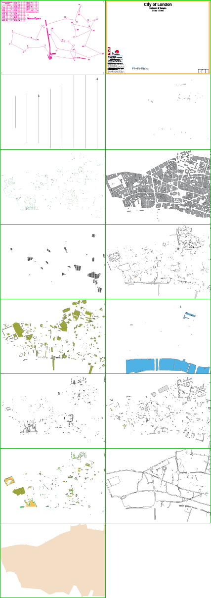
Here’s a version of the club’s logo from the last century:

slow

Through the digging, I’ve discovered two older versions of SLOWprint, the club newsletter – issues 116 and 122, from 1997 and 1998. I’m pretty sure that these are the oldest on the web. The club has been around for several decades though, and there’s over 100 issues of SLOWprint not online – a project for a future club archivist, maybe.

Here’s the logo for the 1998 Southern Express series of orienteering events in (the series started in 1996 and has ceased only quite recently), which amused me a little bit:

sxo

The OK Nuts pages from 1996 are amongst the earliest I could find – they include this quote at the top:

Welcome to SLOW’s first web site for information about Orienteering. It is an experiment, so please bear with us as we try e-mail entry, the map, advance details and results. This has tremendous potential so I hope you support this venture. Any comments will be gratefully received. The site will run from November until the end of December.

Remember the foot-and-mouth crisis back in 2001? It decimated the orienteering season.

Street-O races have been going on for longer than I thought – here’s a mention of one back in Richmond back in 1998.

ASTROFEATURE sounds like something we could definitely do with in Clapham Common or some of our other “feature-light” areas.

Here’s a link to the pages from 1997-9.

Categories
OpenStreetMap

Plinth-O

Well, that was interesting. Slightly hijacking the concept of “art” of the fourth plinth, but good fun anyway.

I turned up, not planning to run, but ended up doing a course on Trafalgar Square in the shape of the letter “T”, as the plinther did a parallel nano-course on the plinth itself.

Here’s the Trafalgar Square and Fourth Plinth orienteering maps.

Volunteers were handing out postcards of the trafalgar square with a copy of the map and details of the Hampstead Heath race (in a couple of weeks) – great idea. There were several hundred in the square (it was Friday lunchtime on a warm and sunny day.) Congrats to Mr & Mrs Maprunner for the planning and organising, and Dadge for plinthing!

Categories
Orienteering

Orienteering on the Fourth Plinth – One and Other O

Orienteering will have its hour of fame tomorrow at 1pm, Trafalgar Square in Central London. Dadge will be up on the fourth plinth, as part of Anthony Gormley’s live art project, doing a very small orienteering course. There will be other courses in the main part of the square at the same time.

A special map has been produced for the occasion, 1:1500 in full colour on a postcard, with details of other orienteering in London on the back. Be there at 1pm to pick up your postcard and take part in some mass participation art.

Have a look at the NopeSport article for more.

Categories
Uncategorized

Orienteering Events this Autumn

Here’s the events I’m thinking of going to this autumn:

11 Sept – Plinth-O, Trafalgar Square at 1pm (It’s not an event, it’s art!)
12 Sept – SLOW City of London Race. I’m the mapper. Now over 500 entries!
13 Sept – SLOW Richmond Park Trail Challenge Half-Marathon
20 Sept – HAVOC Score, Bedfords Park (maybe)
27 Sept – LOK Hampstead Heath
3 Oct – WCH Maize Maze-O (would love to do it if I can work out how to get there/back)
or 3 Oct GO SE Relays, Puttenham Commons, Aldershot
4 Oct – SO Stoughton Wood Regional, Chichester
11 Oct – DEE Chester City Race
13 Oct – SLOW Street-O, Battersea
17 Oct – CUOC Cambridge City Race
18 Oct – LEI CompassSport Cup Final at Fineshade, Peterborough
25 Oct – DFOK Lesnes Abbey Woods
31 Oct – Carcassonne Middle/Short Races, Toulouse, France
1 Nov – Carcassonne Long Race, Toulouse, France
8 Nov – SN Trophy, Mytchett, Basingstoke
10 Nov – SLOW Street-O, Hinchley Wood
14 Nov – DFOK Foot’s Cray (maybe)
21 Nov – SHUOC Sheffield Sprint Races
22 Nov – CHIG Epping Forest East
29 Nov – SLOW OK Nuts Trophy, Bramshott Common, Haslemere
6 Dec – HAVOC Langdon Hills (maybe)
8 Dec – SLOW Street-O, Putney
13 Dec – WCH National Event, Cannock Chase