Categories
OpenStreetMap Orienteering

OpenOrienteering Map Back Online

Following a period of downtime, caused by the rapid increase in size of the OpenStreetMap database, OpenOrienteeringMap is now back online.

There are now two editions – a UK edition which receives the live updates from OpenStreetMap, so will normally show roads and paths that are added to OpenStreetMap within a few minutes of the edit – and a world edition, which no longer updates live, but uses a static database. This database hopefully will be rebuilt occasionally to bring it up to date, although this will result in 3-4 days of downtime each time. The lack of updating, and the update downtime, is due to the limited resources I have at my disposal to run OpenOrienteeringMap. Unfortunately I cannot guarantee long-term availability or that the service will be around forever – my employer will want to reclaim the server eventually!

You can access OpenOrienteeringMap here, there is a new interstital which allows you to select the edition you want. Remember there are two versions, Street-O and “Pseud-O”. The image above shows the Pseud-O map for central Paris. Below is the Street-O map of part of Guayaquil in Ecuador.

Categories
Orienteering

Where in Britain are the Orienteering Races?

As a Saturday-lunchtime project, I have created a heatmap of where the 2700-odd geolocated orienteering races have been held in Great Britain in the last two years.

As you would expect, clusters appear around the main urban areas, where the population sizes supply participation for many local events being put on. Another major bright-spot is the Lake District, generally recognised to be the finest orienteering area in England. Other areas, such as the Cotswolds NW of Oxford, seem to be somewhat underused.

If you have a browser than can handle the HTML5 Canvas tag (i.e. not Internet Explorer!) you can view the heatmap here. Zoom into your local town or city to see if events have been held there – when zooming in, you’ll need to adjust the two sliders most of the way to the right, so that individual events show up. With the individual settings, a single, isolated event will have very little impact on the heatmap.

A look at the London area:

The heatmap was possible thanks to the excellent Heatmap library produced for OpenLayers by Bjoern Hoehrmann. The map is powered by OpenLayers, with an OpenStreetMap basemap. I’ve used a custom colour ramp, based on one supplied by Colorbrewer. The custom map adornments are supplied by MapBox.

Categories
Orienteering

UK Orienteering Fixtures Map – New Version

Cross-posted from my research blog.

Five years ago, I created a mashup of forthcoming orienteering fixtures in Great Britain, as listed by the sport’s national governing body, British Orienteering, on its website. It was based on the Google Maps v2 API, and a regular scraping of the HTML on their website, and was a set of pins on a map, coloured by the number of weeks to the event. On clicking a pin, you got a popup balloon with details of the event, and a link to the organising club’s website. A postcode locator, based on data from the NPEMap project, was added, so you could focus on events in your local area. You could also filter out far away events.

A couple of years later, British Orienteering’s web developers added their own map to their website – Google Maps v2 API based, with pins coloured by the number of weeks to the event, and a popup balloon, a postcode search and distance filter etc etc… The Unique Selling Point of my fixtures map was lost.

So, when a rewrite of British Orienteering’s website just before Christmas broke my map, I took the opportunity to rewrite it, as a vacation project, using the technologies I’ve been using a lot in 2010 – namely OpenLayers, OpenStreetMap, OS OpenData and coloured vector circles. The map is bigger, brighter, and hopefully more useable than the official map and my previous version.

You can see the new map here – with a mass of dots representing forthcoming fixtures, and circles surrounding the “home” postcode, backed by OpenStreetMap, with the postcode locator based on CodePoint Open from Ordnance Survey OpenData. Only the locator uses a database, the rest of the webpage is constructed on-the-fly from a webpage regularly copied from the British Orienteering website.

Not Scarborough…

The map remains subject to the quality of the data entered on the corresponding list – there is some limited tidying up of the data, but it’s difficult to correct grid references that result in events being in the sea – there’s currently one in the Irish Sea, as the event registrant entered “GR” as the grid reference letters, and this just so happens to be the location of the GR myriad. There is still work to be done on my new map, such as spotting obvious errors like this, guessing locations where a grid reference isn’t supplied, and perhaps including Northern Ireland’s events.

Incidentally, my original orienteering web map, which inspired my fixtures map, was one showing orienteering maps, it was written way back in August 2004, using a Flash mapping package by Map Bureau, with dots superimposed on top of a map pinched from Wikipedia. We’ve come a long way.

Categories
Orienteering

Nike+ SportWatch GPS Unveiled at CES

Nike’s unveiled a new GPS watch – the Nike+ SportWatch (press release) for runners, today at CES. It gets launched in the US and UK in April, and other countries soon after.

Currently Garmin has a near-monopoly on sophisticated personal GPS-based watches designed for sports users, with their Forerunner 205/305/405s. They are very popular with orienteers, as being able to record your route means you can graphically see mistakes made, and the different leg speed zones, during a race. Often, at orienteering events, a substantial portion of competitors will be wearing a Garmin Forerunner, so the introduction of a major new player in the field could be very interesting for the sport, and the new competition will hopefully bring prices down for the Garmins too.

The “killer feature” must be the integrated USB socket – no more balancing your GPS watch on a cradle and bringing along a USB cable – you can plug the Nike watch straight into a Mac or PC to download your run data. It also records your heart rate, but “separate heart rate monitor required”.

The GPS element of the Nike watch is powered by Tom Tom, Garmin’s main rivals in the personal GPS space.

Engadget has a hands-on video here.

Categories
Orienteering

Urban Orienteering this Year

The Warwick Town Race was the final urban orienteering race in this year’s Nopesport Urban League, so I thought I would recap the six urban races I enjoyed the most this year – most of them Urban League but with some non-league ones too:

Best 6:

6. Nottingham
I had been meaning to visit Nottingham for ages, and enjoyed this great city centre race, which included the ceremonial Park Estate, an interesting leg up and through the castle complex, and a start/finish in the city’s central square, right underneath a big wheel!

5. Carlisle
A bit of a trek to get to this one, but it was worth the effort, as excellent course planning took us on the sights and included some classic route choice legs, a shopping-centre control near the end, a maze control, and, like Nottingham, a start and finish right in the main town square – excellent for promoting the sport!

4. Lincoln
My third outing here for an urban race, and finally the event is getting the numbers and recognition it deserves. We didn’t get to go in the castle this time, or the city walls or university campus, but instead, like Carlisle, we got a maze control, and a good mix between modern urban areas and the historic centre. Lincoln is one of my favourite orienteering cities and on my must-do list.

3. Didcot
An unexpected delight – the make was entirely in a Milton Keynes-esque housing estate with wiggly roads and unanticipated barriers. Some excellent planning kept the technicality going all the way around. I fell into numerous route traps.

2. Edinburgh
This race is always very early in the year, so is chilly, but the weather was once again sunny. This year’s courses didn’t focus so heavily on the intricate Royal Mile, housing estate and university areas, but the less technical focus was more than made up by the spectacular views on Calton Hill, a section through Princes Street gardens, and some spectacular leg choices including a possible route right through the city station.

1. City of London
A bit cheeky perhaps to put the race I founded and my club organises at No. 1, but this year’s was even better than the first two years. We had a huge turnout – over 700 running on the day – and the race also got the club together spectacularly, running the show smoothly on the day. With Alan as Race Director and Matthais Mahr (of Venice Street Race fame) as the Course Designer this year, the courses and situations were both superb – the weather being perfect, for the third time in a row, also helped. The second half of the courses were in Bankside and Bermondsey, which meant crowds of passers-by were encountered by the competitors – not something experienced in the City proper at the weekend. Next year’s race is already in the planning and will hopefully be even bigger and better.

Cities that I most want to run an urban race in:

  • Bristol
  • Bath
  • St Albans (happening in 2011!)
Categories
Orienteering

Orienteering 2.0

At tomorrow’s City of London Race I’m trying something a bit interactive – a Twitter Wall and Photo Wall for the event. Tweet your photos and comments with hashtag #cityrace and they’ll appear up at http://cityrace.org/live/.

I’ll be taking a few photos of the event and posting them up during the course of the day.

Categories
Orienteering

Third City of London Race – Just A Few Days Away!

The 3rd City of London orienteering race is happening this Saturday, and the entry this year is huge – over 700 people have pre-entered online, and entries on the day will also be taken – assuming there’s any spare maps and start times that is.

With these numbers, I am wondering – is this the second biggest standalone urban orienteering event ever, after Venice?

After last year’s race, which moved a bit west to take in the Temple complex, this time we go south a bit, adding Bankside and Bermondsey to the map. Many courses will start and finish on different sides of the river, ensuring at least one crossing of the Thames during the race will be needed.

My tips for competitors would be:

  • Unlike the City of London itself which is quite at the weekends, parts of Bankside, especially close to the river, can be very busy with pedestrians indeed.
  • We will be enforcing the out-of-bounds rules even more seriously this year, particularly as most courses go near busy roads. If you cross a road marked as out-of-bounds on the map (purple striping) then you will get disqualified. Don’t assume a marshal is going to give you the benefit of the doubt, tell you of or warn you. They will simply disqualify you without notifying you. I was amazed at some people trying to cross a four lane dual carriageway last year, right by a tunnel mouth, with a large barrier and a concrete slipe in the central reservation. Don’t do it! (There will be no tapes on the ground to mark such roads.)
  • The south side of the river is more residential than the north, particularly in the Bermondsey estates. Please be courteous to any residents you meet. Remember, it’s just an urban race, not a championship, and there is no prize money at stake for taking the racing line. Please take particular care not to barge through crowds on the riverside or near Borough Market, even though they may slow you down.
  • If you are on one of the longer courses, your route to the start goes across Tower Bridge – if the bridge has to lift for river traffic, you might be waiting for around 10-15 minutes to cross. However it’s quite a spectacle to see.
  • Don’t forget to go straight to download, which is at the Assembly in T47 Sports Venue, as soon as you finish. You can then return to the Finish to spectate, if you want.
  • Unlike in previous years, we have a licensed bar at the Assembly!
Categories
Orienteering

O-Scape and GhettOCAD

A couple of interesting software programs for orienteering mapping have appeared recently. I haven’t yet looked in depth at either, but both could potentially be very useful for producing new orienteering maps and updating existing ones in the future, and I’m planning on investigating them soon.

The first is O-scape, a set of orienteering-map styles and functionality supplied as a plugin for Inkscape, which is the open source equivalent of Adobe Illustrator (the latter has the Map Studio plugin which I have used to create maps.) If O-scape is as functionally rich as MapStudio, and Inkscape is as capable as Illustrator, then I am planning on migrating my Illustrator maps over – the fully human-readable, flexible SVG format would be a big win. Inkscape is cross-platform (including Linux) and most importantly of all is completely free and open-source.

The second is GhettOCAD, an iPhone/iPad app that allows you to draw orienteering maps electronically as you walk around them! It’s in alpha-stage development at the moment, but could be very interesting.

A killer app would be mixing the two together – O-scape on an iPad. Now there’s a thought!

Categories
Orienteering

Garmin Forerunner 305 Battery Charging Failure – Solved!

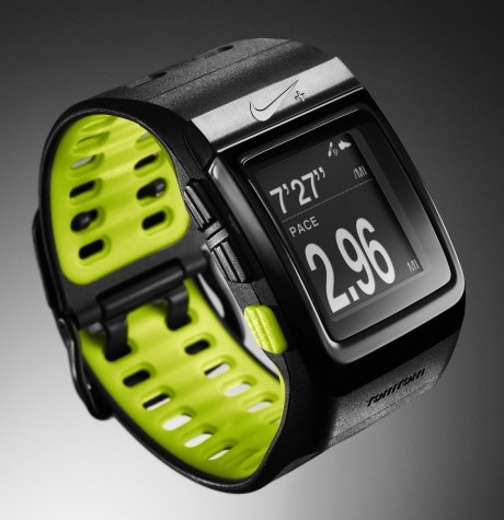
I’ve had my Garmin Forerunner 305 sports GPS for nearly three years now and it’s logged several thousand km of running and cycling. Up until recently it worked pretty flawlessly, but during my recent training tour to Sweden, during a particularly wet and physical run, I noticed it kept switching off. Further investigation revealed that, on tapping the unit, it would switch off. Jumping down various ledges in the tough Swedish terrain was presumably having the same effect. For subsequent runs, it refused to switch on at all, even when doing a soft reset (holding down Mode+Reset and then powering up) or a hard reset (holding down Mode+Enter while switching on).

While being plugged into the charger, the unit would operate fine – although when charging, the “Charging in Progress” would always switch to “Charging Complete” after around five seconds, and on unplugging the charger, the unit would switch off immediately, indicating the battery was completely uncharged.

Scanning various web forums talking about such issues, the soft or hard resets, or a firmware software downgrade/upgrade, were the standard fixes – having tried all of these, it looked like my only solution would be sending the unit back to Garmin for an out-of-warrenty replacement. Apparently, some forums said, they are willing to do this for free, with a quick turnaround, due to a “known manufacturing fault”.

I need my Garmin fixed for Thursday, when it has to navigate me 1000km from Land’s End back to London, so that return-to-manufacturer wasn’t an option. Thankfully, I was able to solve the problem with a little prodding around inside the case.

The Forerunner 305 case is pretty easy to open up, as there are no screws for clips holding the front and the back together – just some weak glue. Prising the two parts apart with a small kitchen knife was straightfoward to do, and on examining the interior, the problem was obvious.

There are eight brass pins on the inside back part of the unit, on the other side of the case from the four charging/communicating contacts that connect to the docking station. The pins are bent back on themselves to provide a hinge to the corresponding eights contacts on the inside front part. The left-most metal pin was completely corroded and had gone green, presumably due to an electrolysis reaction with some water or sweat that had got in the case. Not all of the eight pins are connected to the four charging contacts – the affected one wasn’t, which was why communication with the docking station was working fine. However, this was presumably one that was connected to the battery, which was why the battery was unable to charge.

On touching the corroded pin, the raised section immediately came apart (not good.) After cleaning the gunk away with a pencil eraser, I used the kitchen knife to gently prize the remaining slab under the pin upwards, and bent it back on itself, so that it formed a new, shorter pin. I then put the case back together, joining the two halves with sellotape (for now – I need some silicon glue to make a good fit) and the unit now started charging normally, and appears to work fine.

Categories
OpenStreetMap Orienteering

OOM used for HH Street-O Event

Simon has a good article about how OpenOrienteeringMap was used for a street orienteering event in St Albans. See it here.