Categories
OpenStreetMap Orienteering Training

OpenOrienteeringMap is on Attackpoint

Just a quick post for people who use Attackpoint – >a OpenOrienteeringMap (OOM) is on it! More specifically, you can view GPS routes that people have uploaded, using OpenOrienteeringMap as a background.

To do this:
1. Click on the little “globe” icon beside an entry that has a GPS log. Here’s an example from my Venice Street Race run on Sunday.
2. On the map that loads, click on the “OSM” button on the top right.
3. Click on one of the OOM items on the menu that appears just below the OSM button.

(Note, the global version of OOM is used – this one does not update as the OpenStreetMap database updates, but instead on a more occasional schedule.)

The basemap is based on OpenStreetMap data.

Categories
Orienteering

The Fourth City of London Race

So, the fourth City of London Race happened at the weekend. 1109 people crossed the start line, and with around 80 helpers from South London Orienteers, almost all dressed in the distinctive red City Race helpers tees and hoodies, the event went off pretty smoothly. No controls were vandalised this year, even though we had almost 80 out on the course, and although there were a couple of mistakes on the map (including at a key section in the Barbican), and a normally-locked gate that a number of people discovered open (and ran through), no competitors raised formal complaints. Feedback on Nopesport, Attackpoint and Twitter has been generally very positive. St Giles Terrace and the City of London School for Girls proved to be a brilliant race arena. It was big enough to accommodate everyone, scenic (with the old church, the lake, and a glimpse of the Gherkin if you knew where to look) and visible to the public, some of whom had a go at a course on the day. I don’t think the flats overlooking the arena were unduly disturbed by the noise – it turns out that once the fountains in the lake switch on in the morning, everything else is drowned out.

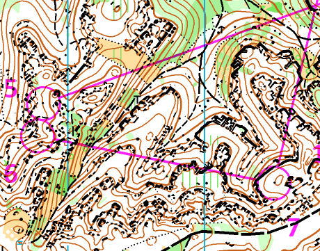
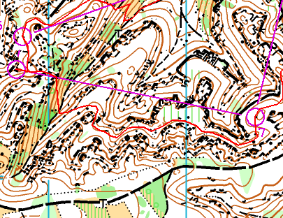
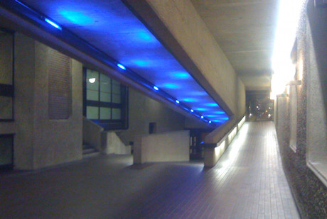
During the event, I was able to spend most of my time out in the Barbican Estate itself, taking numerous photographs of runners at various levels and angles – you can see 156 of the best here. I only needed a few urgent trips out on the bike – to rehang a control higher, hang two in a park that only opened just before the event start, and tape off an illegal approach to a control hung by a (low) uncrossable wall. Other developing issues, such as a poorly mapped set of stairs confusing some people, were left unchanged so as not to make it even more unfair for the early runners.

We know some people ran out of bounds (N.B. The person in the photo here is in-bounds!) – through the aforementioned locked gate for instance, and one person with a headcam filmed himself running into the Barbican centre, up a couple of internal stairwells and back out onto the map. There were other similar quirks, and also roadworks that disappeared in the few days before the event, while several others sprang up. Crossrail’s and Thameslink’s impact on the City should not be underestimated, and hoarding lines seem to change on an almost daily basis. The City also itself is carrying out many “Streetscene” enhancements, gradually pedestrianising and beautifying areas, the skyscraper builders are hard at work anticipating the next boom, and Thames Water is desperate to find all those leaks. It’s not my final call, but I don’t think we are disqualifying anyone – it’s not a Championship, we don’t think these wrinkles materially affected the results enough (the notorious gate saved people at most 40m and a couple of turns), and it’s part of what makes it an urban race, rather than a sprint or a regular orienteering event where the land is more static and reliable. I’m sure that gate will be taped in future years though…

We had great difficulty accommodating the 209-odd starters on the Men’s Long course – fewer than expected opted for Men’s Short on entering. Maybe a Men’s Elite (with a hard limit of say 90, at two minute intervals, and entry by invitation from the Men’s Long start list) would be the way to go. At the same time, I dislike having a Men’s Short with a prize for the winner. People are in fact allowed to enter any course at non-Championship events like this, and many people treat Men’s Short as a course to run if they are injured, want an easy run, or consider themselves to be “not competitive” rather than as a genuine competitive course. This is why the Men’s Short course had two people who finished well ahead of the rest, and who have scored far more points than indeed the winner of the Men’s Long. So maybe an invited Men’s Elite and general Men’s Open should be the split for future years.

The event organising team is, I think, now suffering somewhat from volunteer fatigue. I know that the time spent on the event by many in SLOW (the organising club) was great – probably too great. In my case, the great majority of the time was spent on the “labour-of-love” work of extending, updating and correcting the map that I have nurtured now for over four years, exploring the new parts of the City, test-running, and running the event’s website – including a “live page” on the day that I was able to post photos to, and gather tweets from others. Only the last-minute worrying and what-if-ing of the final two weeks was the bit I would rather avoid! The traditional organising truimviate of planner, organiser and controller also spent more time than they normally would on a “bog-standard orienteering event”. It was a lot of time, but the result was a polished event – I thought the planner’s courses this year were the best yet, even the very first leg had three possible routes and an immediate decision to be taken by most competitors.

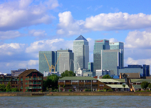
It will also be interesting seeing what happens to the event, now that it is the biggest urban orienteering race in the UK, and quite possibly the second biggest in the world after Venice. Certainly, the 300-odd overseas competitors gave the event a lovely international feel – particularly as the overseas designs of orienteering tops generally look a lot better. I have already written my thoughts on what could happen to urban orienteering in London in general. Clearly there is a certain expectation amongst both the local orienteering community and the o-tourist, for future “city style” events, where the typical run is for an hour and the route, while not necessarily being very technical, passes several of the “London landmarks” – this year St Paul’s Cathedral, the Gherkin, Lloyds of London and of course the Barbican were visited by many. But at the same time I think the format needs to be tweaked and refined to keep it fresh. Certainly we have overused the Barbican Estate now – it was used a lot in 2008 and a bit in 2009, and a huge amount this year – so I expect that this will play almost no part in races for the next few years – not least because of impact on the residents and the difficulty of negotiating access. With next year’s pairing with the Southern Championships in nearby Epping Forest the following day, perhaps there is a case for having shorter courses with target winning times of say 35 minutes – i.e. a “middle-distance” urban race which, due to the higher pace and shorter legs, would also allow less technical areas to be enjoyed more. There is also perhaps less pressure on keeping the race “technical” anyway, as the following day’s event should satisfy in that regard.

Now, back to the regular orienteering – Street-Os in London, “real” orienteering outside such as the CompassSport Cup Final and a Mountain Marathon, and enjoying the efforts of other urban race organisers – Cambridge in October should be a real treat with the college quadrangles, and I might even make it back to the granddaddy of urban racing – Venice.

See also the report from Brooner, the co-founder of the City of London Race.
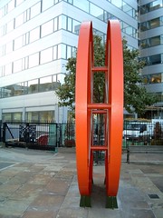
Categories
Orienteering

The Future of City Races in London

The fourth City of London Orienteering Race is only a few days away, and with the maps off to the printer, and the final details out, the organisation team can start to relax a little and keep our fingers crossed for good weather on the day.

I first thought of the idea of putting on a City Race in London in November 2007, after a low-key Street-O event was organised in the City, and Bankside, by my club South London Orienteers. A discussion with the race director of the Rat Race was crucial, in determining that the City of London Corporation were enthusiastic and helpful with such events taking place. Brooner, with his key experience of organising modern orienteering races and adventure races, such as the Purple Thistle and Rat Race, and structuring the Nopesport Urban League, was soon on board, and together we managed to get over 400 people to the first event in October 2008. Along the way I had organised a test event, at Queen Mary University of London, using a map prepared in Adobe Illustrator, to test the printing and map quality. Being able to use a Mac, and Illustrator, was the key motivator in producing the City of London map, as was having a lot of free time, as I took a year out to study for an MSc at City University, just up the road.

The strength and depth of experience in South London Orienteers meant we had a large number of volunteers on the day to make things run smoothly, and the first event was a great success. I should also mention the controller, Simon Errington, whose experience of sprint and urban events at the highest level was invaluable at steering us towards producing great courses for the race.

Since then the race has grown and grown. Last year we had the previous year’s Venice Street Race planner on board to design the courses – Matthias Mahr. With Venice being the biggest urban orienteering race in the world, this certainly helped with the profile of the the event abroad, and the current race director, Alan Leakey, has also been abroad frequently, spreading the message. We now have over 1100 entered for Saturday’s race, including 300 from abroad, and 100 non-club runners – likely new to orienteering. The map has spread west, south and (this year) north for each edition of the race.

So what next? Well, the City Race itself will doubtless still keep going. We were hoping to use Canary Wharf and the Isle of Dogs for next year’s race, but filming in the former area has put paid to that. There is also some potential for expanding the map east, at the expense of constricting the courses somewhat. A new format, such as a middle-distance race or Stockholm City Cup style event, might be an option.

So it’s not just the City that can host major urban races in London. Other places include:

  • Isle of Dogs and Canary Wharf – an obvious location with the glamour of the skyscrapers in Canary Wharf and the river and dock features.
  • Hampstead – used by LOK for a Street-O, but combining this with part of Hampstead Heath would make for a great urban event – plenty of hills to make it interesting too.
  • Kingston – already mapped for a potential future sprint by Matthias.
  • Wapping and Bermondsey
  • Rotherhithe Peninsula
  • Queen Elizabeth Olympic Park – we are unlikely to have access to all of it for many years to come as much of it is actually earmarked for housing, but there will still be a decent expanse of parkland, and the sports venues themselves, which may be accessible from 2014 onwards.
  • A race at night in the City
  • Extending the current map south-west to cover parts of the South Bank.

I don’t think a large race could happen in the commercial centre of London – the West End – because of the volume of traffic. However LOK do organise an annual evening Street-O event in this area.

I hope that other city races in London, and indeed elsewhere (hello Bristol!) would follow a few key ideas that we have tried to adopt for the City of London Race:

  • Iconic race arenas which are not hidden away from the public. Admittedly there aren’t many passers-by around in the City at the weekend.
  • Distinctive uniforms for marshals and helpers. We have distinctive red T-shirts and hoodies.
  • Freebies for the aforementioned helpers. They get to keep their T-shirts.
  • Nice weather. We’ve been lucky three years in a row!
  • A dedicated website.
  • An emphasis on photographs rather than text and maps, in the publicity.
  • Visiting iconic features on the courses, even at slight expense of course quality – although we at least haven’t needed to compromise significantly.
  • Use of social media. This is becoming more and more important. We have a Facebook event with over 100 RSVPs, a Twitter account and Attackpoint event. The race is also being discussed on Nopesport and is listed on Runnersworld.
Categories
Orienteering

Scotland to host the 2015 World Orienteering Championships

The IOF (International Orienteering Federation) today announced that Scotland has won its bid to host the World Orienteering Championships in 2015, in the Aviemore and Moray area.

Here’s an excellently produced video summarising the bid.

Categories
Orienteering

Summer Plans 2011

I’m now fixed, finally, after my fall in Sicily, and back to running again. My first event since recovering was the Bushy Park Trail Challenge that SLOW, my orienteering club, organises every year. It’s roughly a 10K run. I didn’t feel particularly fast out there – although I did sprint for the line at the end. My quads were screaming for about two days afterwards – to the point that I was holding onto bannisters walking down stairs. It’s amazing what a couple of months off does to your fitness – I was still cycling every day so thought I had a good base fitness, but I guess not.

Anyway, this summer is looking like:

  • London Park Race series. Generally Tuesday evenings in June and Thursday evenings in July. I’m doing the website again so will be quite involved, although I think I’ve managed to offload the publicity this year. The Park Race events are generally quite short (5K) and finish in a pub, which is good.
  • parkrun. I’ve done 47 of these over the last four years, and really want to do three more soon, to get a highly coveted (and very red) parkrun 50 technical shirt. As seems to happen often in the summer, it’s going to be a while before I can run those three Saturday 9am 5Ks – 2 July, 9 July (slowly) and 13 August are the next three free days.
  • Ripon and York urban double – 29/30 May.
  • Nottingham urban race – 5 June
  • Lossie/Culbin double weekend – 11/12 June. A long way to travel but should be great.
  • Great Wilderness munroing – 13-16 June. Might as well as I’m up there.
  • North Downs Way Relay – 25 June. Don’t think I’ll be fit enough to break the record for the leg I’m on – this year at least.
  • Saxons Trail Challenge Half Marathon – 10 July. Knole Park near Sevenoaks, and along to the east. Should be lovely.
  • Scottish 6 Days – 31 July – 6 August. Really looking forward to this, I have ambitiously entered elite, so really need to step up my training.
Categories
Orienteering

City of London Race 2011 – Preview

It’s the fourth year for the City of London Orienteering Race, which is taking place on 10 September (entries open!). It’s also the fourth year that I’m producing the map for the race. Having extended the map westwards to Temple for 2009, and southwards to Bankside for 2010, this year we are moving northwards to Finsbury. There are three distinct new areas being mapped, here’s a preview of them:

1. West Shoreditch

A slightly scruffy quarter, where slightly dilapidated offices mix with “interesting” looking independent car parks. It is the surprisingly quiet “no-mans land” between super-trendy Hoxton with its hipsters and bars and the City with its financial workers – and bars. Nearby is the Old Street Roundabout, often nicknamed “Silicon Roundabout” today as the hub of London’s tech startup industry.

Hitchcock’s Reel, known locally as “The Disco Biscuit”, is a large sculpture in the centre of the area.

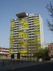
2. Golden Lane Estate
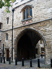
The most interesting part of the new map, the Golden Lane Estate is adjacent to the Barbican and also features some of the Barbican’s characteristic multi-level urban landscape and dramatic concrete structures. It is certain to be a highlight of most courses.

The local area also includes the Quaker Gardens and Bunhill Fields, a large and historic park and cemetery where Daniel Defoe, John Bunyan and William Blake are amongst those buried. The Honourable Artillery Company also have a barracks, large parade ground and field in the area, which is often used for cricket games.

3. Clerkenwell

Clerkenwell’s most distinctive feature is the 500 year-old St John’s Gate. There are also a number of narrow passageways and alleys in the area, reminiscent of the most ancient parts of the City to the south. St John Street runs through the area, on it is the Michelin-starred St John Restaurant. Located immediately north of Smithfield, London’s meat wholesale market, it is often rated as one of the world’s top restaurants and is famous for its offal items on the menu, and “nose to tail” eating. Not one for the vegetarians…

As well as the new parts of the map, the existing area is being updated to reflect the changes in the last few years. The City is constantly evolving, with old office blocks being demolished and new ones built in their place.

Photos – Top: Partial by Jeff Van Campen, Middle: By Cowfish, Bottom: St John’s Arch by Peter Gasston

Categories
Orienteering

Varsity Match 2011

I was the Czech Republic over the weekend, at Doksy, which is north of Prague and near the German border, for the 2011 orienteering Varsity Match. After a “model event” on the Friday to familiarise ourselves with the sandstone terrain, the match itself was on Saturday, and a 3×2-man relay on the Sunday.

The sandstone terrain is quite distinctive – lots of rock pillars and cliffs, generally 5-10 metres high. The cliffs occur in lines, meandering horizontally but generally at the same height. This means that natural terraces between the cliffs provide opportunities for fast, level running, in terrain that first glance looks intimidating. Groups of rocks often have distinctive horizontal breaks, often occuring at right-angles to each other, resulting in “sandstone cities” – passages which can be navigated along between the rocks. The passages are generally less than a metre wide with vertical rock on either side. Careful mapreading is required to ensure the route followed doesn’t lead to a dead-end or a rocky drop, but the modern maps we used during the weekend have been produced to a very high standard by the stanstones.cz team.

The model event had plenty of controls in “theatrical” locations such as narrow rock passages, with some crag-hopping possible in a couple of locations. The actual varsity match though was mainly about good route choice, i.e. go through the complicated terrain, or go around, or (sometimes) choose a shorter but steeper way around. As I was walking the course (as injured) I generally opted to go straight – less walking, and also generally the more scenic option.

Here’s my route between 6 and 7, following a terrace between two sets of sandstone cliffs. You can also see some sandstone cities, NW of No. 7, although my route didn’t visit them.

Results and course maps.

Categories
Orienteering

MOC 2011 – Orienteering, Sicilian Style!


I’ve just got back from Sicily, where I was taking part in the Mediterranean Orienteering Championships. The three-stage event, consisting of two sprint races and a middle-distance race, was organised by Park World Tour Italia. Highlights of the trip were the spectacular event locations, particularly the finish arenas, and the passion and enthusiasm of the organisers. Sicily in late March is very pleasant – sunny and warm but not too hot. The locals were wrapped up well but the Scandinavians and Brits at the event were only too happy to enjoy the lovely conditions.

Day 1 was a sprint race around the historic old centre of Sciacca, on the south coast of Sicily. The area was steep, with many staircases and narrow, winding streets. Police kept cars out of the area for the duration of the race, although runners still had to dodge many moped riders. The finish arena, in a historic plaza surrounded by palm trees and curious locals, was further enhanced by the appearance of many dancers, wearing hats with three legs coming out of them (the Scilian coat-of-arms) who not only danced to the various Europop-esque tunes, but also cheered in each finisher. The costumes and performers were from a more general parade a few days before.

I didn’t have a great race – I loved the map and the city (once we got there – Nick Manfredi having driven us 100km in the wrong direction!), but I went a bit too fast and made a silly 90-degree mistake around half-way through the race, running off the map and wasting four minutes trying to get back on the course. Four minutes for a 20-minute sprint race is pretty disastrous, so I finished comfortably in the bottom quarter.

Day 2 was another sprint, this time in and around the ruined village of Gibellina. The village destroyed in an earthquake in 1968 and the central part of it has been turned into a giant concrete memorial, with the road network preserved but the housing outlines replaced by 1m high concrete walls. An area of terraces (i.e lots of tricky and dangerous one-side walls) and the housing rubble of another part of the village were also used.

I didn’t make any big errors this time, but was a bit slow around the course – I just didn’t have the sprint pace. Afterwards we had a look around the new Gibellina town, built to replace the village and full of modern art. Kind of like Milton Keynes but with more of an emphasis on public art and less on roundabouts…

Finally, there was a middle distance race around the ruined Greek temples of Selinunte. We could see the finish arena being constructed on the village pier, from our hotel breakfast room overlooking the Mediterranean. The race itself included quite a bit of dune running, as well as a spectacular section in one of the temple complexes. Unfortunately, on leaving the complex I slipped and fell at speed onto one of the temple blocks – I was able to run to the end, but it looks like I’ve managed to break one of my ribs – so no running for a few weeks. Luckily this was on the final day so didn’t spoil an amazing orienteering weekend and unexpected holiday.

Congratulations to Sarah Rollins who finished second in a very competitive field of Swedish world-championship orienteers and other internationals, so winning a EUR400 cash prize.

Categories
Orienteering

Park World Tour – Perth Race Video

Scottish Orienteering have produced this video of the Park World Tour race that was held in Perth City Centre last year.

Bear with the gratuitous slow-mo and the guy jumping out of the bin at the start – and note how the women’s race is completely dominated by the Swedes!

I was unable to go to the (spectator) race, I wish I had made it, it looks like it was great!

Categories
Orienteering

Population Pyramid of Scottish 6 Day Orienteering Entries

Here’s a population pyramid of the entries so far for this summer’s Scottish Six Days (S6D) orienteering event, based on the 2000-odd people on the entry list shortly after the cheap entries’ closing date.

At first glance it looks like the demographic is horribly unbalanced. There is definitely a “hole” in the middle! However, there are some possible mitigating factors:
1. Older people might be more keen on entering early so that their plans for the summer are organised well in advance. Younger people are less organised?
2. Younger people are maybe more likely to be injured due to their faster running speeds, so only want to enter when they are more confident of being injury free?
3. Younger people’s incomes are more vulnerable to change so they are waiting to enter closer to the event (£90+ entry fee for the six days) when they are sure they can afford it?
4. Older people are more affluent and so happy to enter a long time in advance and then maybe not show up?
5. Leave is harder to arrange for younger workers?
6. Younger people are more weather sensitive and want to see what sort of summer it’s going to be in a notoriously wet (or midgy) part of Scotland, before entering?

Here’s what the Office of National Statistics’ population pyramid for the UK population for 2011 looks like – you can see this for yourself at the ONS website:

Bear in mind that this is just the UK population, and 20% of the entries for the S6D so far are from foreigners. The age axis for the ONS pyramid starts at zero.

(N.B. The ages for the S6D pyramid are based on the age at 31 December, rather than at the event date in August. Ages are also averaged through the age bands – 2-year for juniors, 5-year for vets – for which the data is available. I have assumed that all the M/W10s are aged 9 or 10.)