Categories
Leisure Olympic Park OpenStreetMap

Olympic Park Rising

7629386754_86db110501

The Olympic Park in east London was a flurry of colour and activity during a few weeks in summer 2012, but since then it has been largely locked away – a parcel of land opened last year, but with a security fence, access only from certain points and at certain hours, it hasn’t really felt like a proper park. A few cycleways have also appeared, but considering the “blank slate” of the area, they are laughably awful. Tradtionally the excuse for London’s poor standard of cycle tracks is that the roads are too narrow to fit them in, or there’s too much traffic to close a lane for cyclists. Both of these are rubbish reasons for many of our streets of course, but the lack of positive and effective action (apart from in a few isolated places) has allowed places like New York to leap-frog London as cycle friendly cities – during Autumn, more people used the bike-sharing system in New York than in London. I really hope it’s not too late to fix these mistakes.

The good news is that a lot more of the park is due to open very soon. The Aquatic Centre and the Velodrome are due to open in March, along with the outside BMX, mountain bike and road tracks. I’m rather disappointed that we’ll have to pay to use the latter, I had originally envisaged all the bridges being open to the public at all times, but with two of the bridges are forming the circuit, this will represent quite a large part of the park that is fenced off. I appreciate the venue buildings need to be self-sustaining in funding but it’s a shame that the outdoor as well as the indoor circuits are pay-to-play.

Then in April the south of the park reopens, and the Orbit. The orbit will, I’m sure, be about as popular as the cable car, at least until the view improves, but with the southern part of the park opening up, finally there will be a large, green(-ish) space which just might start to feel like a proper London park.

olympicpark_jan2014

One thing that is going to need updating is the map. The official one is really not that great (What do the dashes mean? What do the dots mean? Why are the open areas outside the park shown in the same grey as closed areas inside the park?) so we’ll have to turn to the crowdsourced map of choice, OpenStreetMap. This map (above) isn’t looking great at all either at the moment – some features that were around only in 2012, such as the athlete’s access tunnel across the Greenway, are still on there. Red dashes show out of bounds paths – how many of these will come in bounds in March/April? So we’ll need a Mapping Party some time there in April/May, and after that, the map should look pretty good.

The park was great for a few weeks in 2012, but the slow pace of opening, and the efforts so far, have been disappointing. But despite my grumbles above I’m greatly looking forward to the park opening, them sorting out the cycle lanes and access, and it maybe becoming, one day, a great space for cycling through, jogging in, or maybe even a bit of park orienteering?

Map © OpenStreetMap & contributors.

Categories
Leisure

San Francisco

IMG_1296ec

So… I went on a holiday last month to San Francisco. I’d been planning on a return to the west coast of America since a trip to Vancouver for a conference in summer 2012, and San Francisco is one of those places I’d seen a lot about but never actually visited. The excuse to finally make a visit was the combination of (1) a series of orienteering sprint events – Sprint the Golden Gate (2) cheap-ish flights – £525 return, and (3) various friends from school and university who have made it over there on a semi-permanent basis.

As December approached, the orienteering series was looking a bit shaky – permit problems, which I can strongly relate to with the inevitable permissions headaches that arise year on year with the London City Race. But I went ahead and entered. US orienteering races are extremely expensive to enter compared with the UK/Europe, due to insurance and expensive park permits needing to be included, but conversely the GBP/USD exchange rate has shifted quite a bit recently, making the US a cheaper place to visit than historically.

I arranged to crash on the floor of a friend’s apartment in the Marina District, and to meet up with four others who I knew were probably nearby. I had the Lonely Planet guidebook but the plan wasn’t to look at it that much! As is reasonable for a city of such beauty, I took a lot of photos (400+) and the best 70 are linked in the text below, and can be viewed on one page on Flickr.

Tuesday – Arriving

The flight over was OK, although the route was intriguing – going very far north, further than I thought we would, so that we were quickly into the Arctic Circle and, as happens at this time of year, even though it was the middle of the day, it got pretty dark outside. To possible take advantage of the unusually strong jetstream, which has been plaguing the UK with storms for the last month, we actually “overshot” the west coast of North America and headed right over Vancouver, before heading south-east to San Francisco itself.

I had a few hours before my friend appeared from work, so I got the BART into downtown, picked up a T-Mobile $3/day SIM, accidentally walked straight past the famous Apple Store and a bikeshare docking station, and wandered down to the Ferry Building, from where there is a great view of the Bay Bridge which currently has an evening lightshow. I then did a long, gradual walk anti-clockwise along Embarcadero, first heading past the new location of the Exploratorium and some outdoor exhibits, and then to Pier 39, a slightly kitsch but popular food/gift arcade. Taking a side-route out, I completely unexpectedly came straight across the sealion colony, which was making an amazing racket. Apparently they’ve been there pretty much since the pier was built. Checking the map, Russia Hill sounded like an interesting name, so I headed south, eventually making it to the hill up some impressively steep roads and flights of steps. I then headed over to the famous squiggly bit of Lombard and then a long walk along Chestnut down to the Marina District.

Wednesday – Walking

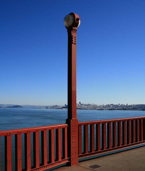
This was the big walk day – I walked 18 miles in the end. From the Marina District I headed north to the marina itself, to visit the Wave Organ sculpture there – with great views of Alcatraz Island and the Golden Gate Bridge – we’ve all seen a thousand images of it but there is no substitute for the thrill of seeing the most famous bridge in the world for the first time in real life. I then walked around the park at the pseudo-Greco-Roman Palace of Fine Arts, and then back to the shoreline, through Crissy Field and to the Golden Gate Bridge itself – the way on to the bridge wasn’t immediately obvious so I overshot a bit at first, and ended up under the bridge at Fort Point. After various tourist pics from and of the bridge, I headed off the far end of the bridge into Marin County. The walking route north doesn’t go much further (no pavement) so I had to get a bus from here to Sausalito, where I had half an hour to wander around – little to see though – before getting the ferry back to San Francisco. The ferry takes a great route, passing nearby Alcatraz Island, and with a symmetrical view of the Bay Bridge, before ending appropriately at the Ferry Building.

IMG_1348e

After grabbing lunch at some boutique stalls in the Ferry Building (think Borough Market but even fancier) I walked down Market to the famous cable car turnaround at Powell. After the inevitable wait in the tourist queue, watching cars getting rotated, I got a cable car over to Hyde and Bay, before walking back up Hyde – very steep – and down the wiggly bit of Lombard again. Then along Lombard to Telegraph Hill and the Coit Tower (closed) for a 360-degree sunset view. Down the wrong set of steps to Levi Plaza, back up the right set, down again to Downtown, around the Transamerica Pyramid, the Bank of America plaza & tree, and Union Square with its Christmas tree and Macy’s. Then a loop up to and around Chinatown and Dragon Gate, and a long walk along Geary, through Tenderloin (a starkly downtrodden area), to Japantown with its concrete pagoda and a pocket park. More hills found on the way back to the Marina District!

Thursday – Silicon Valley

First, a slow bus through rush hour, right across San Francisco to the Caltrain terminal. I made my connection with a minute to spare and got the huge and impressive Caltrain “Baby Bullet” double-decker train service down to Palo Alto. I then spent an hour walking to and around Stanford’s otherworldly university campus – including longer than planned in the unexpectedly massive Stanford team shop – before walking back to Palo Alto to get a lift to the Facebook HQ for a quick tour and lunch with a friend from university. Then an hour’s walk through American suburbia all the way back to Palo Alto station.

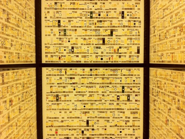
The original plan was to visit a friend at the Googleplex, but this didn’t work out, so I got a couple of buses instead over to the Computer History Museum. Highlights for me were an original Cray 1 Supercomputer (the circular black casing with “seats” still looks very cool) and an Apple I in a wooden case, signed “Woz”. Finally another long walk through Mountain View surburbia – Silicon Valley railway stations being sparse – and the Caltrain back into San Francisco. Signage is poor around the Caltrain terminal – I somehow ended up in front of the SF Giants stadium why trying to find my bus stop back. The bus gradually filled up with homeless people – it was a very cold evening, almost freezing, which is unusual for San Francisco – despite the best attempts of the bus driver: “you can’t go round and round for ever!”. It was a short walk up into Cow Hollow for an evening meal.

Friday – West

Another long-ish walk, this time south from Cow Hollow, first steeply uphill to Broadway, then to Alta Vista Park, then Alamo Park, and then the Lower Haight. I had lunch here at a cool Shoreditch-style coffee shop, but somehow missed out the more famous Upper Haight, by following the “Wiggle” cycle route to and through Panhandle Park. I cheated a bit here – Golden Gate Park and Upper Richmond go on a long way, so got a bus down to Ocean View and walked along the beach beside the Pacific, as the only clouds of the week gathered offshore. To Land’s End and the first orienteering sprint of the week, a short, but hilly forest sprint with a great multi-level ladders-and-platforms section in an old water facility. Then, a long journey from the far western tip of San Francisco, right over to Berkeley, to meet up with a schoolfriend. I didn’t see any of the university, or indeed much of Berkeley itself, as it was pouring with rain.

Saturday – Sprints

Three more orienteering forest sprints today. First, a couple in the middle part of Golden Gate Park, near the polo pitch. We were seeded and then started in groups. A warm down jog around the polo pitch’s perimeter track was 1.3km for a single lap! Then lunch in Irving – the second Chinatown of San Francisco, and then a long and slow bus right over to John MacLaren Park at the other end of the city for a final afternoon sprint. I struggled in the hilly terrain. Evening was a more formal dinner in the Mission District.

Sunday – Final Day

An early start to get to one last orienteering race – at San Francisco State University. A long way from the Marina District but thankfully a direct bus there, on a spectacular route – almost going across the Golden Gate Bridge, but turning at the last minute onto the Presidio, through Golden Gate Park and down 19th Street. The was the only campus sprint of the series and, though the area was small and limited, a good course was got out of it.

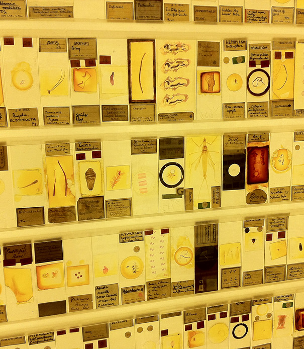
Afterwards I headed up through Stonestown to Forest Hill and Twin Peaks. Perhaps the most iconic view in the whole city from here. Then I headed north through tiny Tank Hill Park, to the edge of Golden Gate Park to the California Academy of Sciences which was having a free day (normally $25). It was, predictably, very busy, and the queues were too long for the earthquake experience, the tropical biome and the planetarium, so I only made it to the aquarium and the “Tellytubbies” garden roof, plus a rather underwhelming pen with a couple of reindeer and, randomly, some live penguins in a hall of stuffed animals. The CAS is an odd place really, the name is a bit of a misnomer, and the equivalents in London – the Science Museum, the Natural History Museum and the Horniman Museum’s aquarium, better combine the academic, educational, cultural and fun aspects of a good museum, while the CAS is only really strong on the large part. But I think we are a bit spoilt by our great museums here in London.

Finally, the journey home. A bus back to the Marina District, then another bus, then I just had time for another Cable Car journey back, from Hyde and Bay, to Powell. Then it was the BART to the airport and the inevitable jetlag to hit two days later…

An beautiful, exciting city with something interesting over every summit – I had a real sense of regret on leaving, knowing that life is just better here than back at home! I missed out on quite a few things to see that were on my internal list – the Exploratorium, the De Young Museum, Berkley University, the Googleplex in Mountain View, San Jose, the Cable Car Museum, Fisherman’s Wharf, the fog, the viewpoint NW of the Golden Gate Bridge, cycling, Muir Woods and of course Alcatraz.

Golden Gate Lighting Post (1291)Greenland Mountains in Ice (5194)The Apple Store (5206)Bay Area Bike Share (5207)Bay Bridge Light Installation (5209)Christmas Tree at Pier 39 (5214)
Do Not Drive on Tracks (5219)Citizen Chain (5220)Wave Organ (1215)Alcatraz Island (1218)Wave Organ Detail (1223)Palace of Fine Arts from Baker (1233)
Palace of Fine Arts Interior (1246)Walk with a View (1252)Dogs and the Bridge (1258)The Golden Gate Bridge (1261)Bike Highway leading up to the Bridge (1265)No U Turn (1269)
Map of Bridge on Bridge (1271)San Francisco from the Golden Gate Bridge (1277)No Trespassing (1278)Golden Gate Bridge Cables (1284)Rivets in Red (1287)Golden Gate Lighting Post (1296)

San Francisco, December 2013, a set on Flickr.

Categories
Leisure

Walthamstow Reservoirs

walt1

The Walthamstow Reservoirs are a true London secret, a huge area of lakes, trees and paths, which is publically accessible but largely unknown. The only people you are likely to meet in it are anglers and birdwatchers, both groups that thrive in a quiet environment and so I’m sure would rather the secret remained! But the area covers a huge part of central(ish) London and deserves to be known by more. There are plans mooted to open it up although nothing concrete. I took a trip into the reserve on Sunday, to have a look around.

Anyone can get in to the reserve, which is generally open during daylight hours (e.g. 8am to 5pm from October to March). There is only one public entrance, which is opposite the Ferry Boat Inn, on Ferry Lane, the road which runs across the Lea Valley, between Tottenham and Walthamstow. Tottenham Hale station is about a five minute walk away. The complex is owned by Thames Water, who enforce a permit system. On entering, go to the shack immediately on the right, fill out a pink form and hand it over to the warden there, along with £1. You’ll get half of the slip back, which acts as your permit.

You then pass through a narrow passage underneath the London Overground “GOBLIN” route, past a decaying Victorian pumping station – with some attractive lampholders attached to it – and then to various paths radiating out from this point into the reserve.

walt3

At the far end there is The Coppermill, a historic building which used to, as the name implies, mill copper into coins. These days it is used as part of the reservoir operations.

walt2

View all my photos from the Walthamstow Reservoirs here.

Categories
Cycling Leisure Munros

Montrose to Mount Keen – Journey to Munro #200

keen1

A week up in Scotland, with my road bike, and settled weather, was the ideal chance to pick off some slightly more inaccessible Munros.

Mount Keen is the most easterly of all the Munros, and well isolated from the other multi-Munro ranges around Glensheet and Cairngorm. It’s firmly in the middle of the Angus glens area and 25 miles from the nearest station, Montrose. Ideal for cycling then, particularly as I always wanted to cycle up the 15-mile dead-end road through Glen Esk. The Munro can be climbed from the north or the south – I picked the latter, which starts at Invermark, near the head of the glen.

The cycling section was pleasant, with quiet roads the whole way and a notable 6km section through Edzell Woods that was flat and straight as an arrow, while still being almost free of traffic. Crossing the A96 was daunting but a useful old road fragment makes this easier. The road through Glen Esk climbs steadily, but it’s only 300m in all.

keen3

The walking was also straightforward, with undoubtably the best Munroing path I’ve ever been on, probably laid and drained virtually to the summit. This was especially good as, having forgotten to bring my walking boots, I was in my regular road running shoes. I was up and down quickly, covering the 18km distance (with 700m climb) in less than four hours including breaks. Route map.

keen2

On the way out, I stopped at the Queen’s Well (top photo), a monument which was laid to commemorate a journey by Queen Victoria over the nearby Mounth Road, an old droving route which is just a track and climbs to 800m. I also visited an old fort which was by the start at Invermark, built high to keep an watchful eye on illegal cattle movements!

The cycle back was pleasant, arriving just as it got dark. I was quiet tired by this stage, so a smoked sausage supper, and Irn Bru, were quickly consumed while I waited for the last train back home. It was 4h40 of cycling, and 90km altogether.

Nice to have got #200 out the way, even if it has taken me 20+ years to get this far now. Only 82 more to do!

Photo gallery

keen4

Categories
Leisure

North Downs Way Relay

I ran in the annual North Downs Way Relay for the third time, last Saturday, covering the leg from Charing to Hollingbourne. This year’s race was in very hot weather and the team suffered injuries, hospitalisations and several people getting lost – however somehow we still managed to get the win – albeit in one of the slowest times ever. The race is a relay running along the length of the North Downs Way from Dover to Farnham. Sometimes, including this year, the race is split into two halves, with two simultaneous mini-relays running from the ends to a central finish at the Vigo Inn.

This year’s leg winners were each presented with a hand-painted mug showing their leg on it, as well as some of the sights on the way. Having won my leg (one of the shorter and easier ones at 13km with not too much climbing) I was pleased to be awarded my mug at the prizegiving, which was in the pub garden of the inn.

Here’s my leg:
ndwroute

Categories
Leisure

The Micrarium at the Grant Museum

mic1

I was at the Grant Museum of Zoology, one of UCL’s public museums in Bloomsbury, last week, helping install a new set of iPads for some interactive exhibits in there. The museum a small but fascinating space, it has been around since the 1820s but recently moved into a, larger space, although it still has a lovely old-fashioned feel to it, with display cabinets and drawers full of unusual stuffed or pickled animals, such as the Jar of Moles.

Anyway, I was delighted to finally visit the Micrarium, a new exhibit dedicated to the very small, it consists of three walls crammed full of slides of tiny things, displayed around a booth that you can walk into, with a mirror on the ceiling to complete the effect. While looking at the tiny specimens is an interesting exercise in itself, I was particularly taken with the design. Unlike the rest of the museum, which is mainly made of varnished wood cases and dimly lit for preservation reasons, the Micrarium is strikingly lit and immediately invites closer investigation – you have to get up close and personal with these tiny specimens in order to simply see what they are.

The idea of having a “all around you” booth in a museum reminds me of the “interactive Booth map” at the Museum of London, which I visited shortly after it opened a couple of years back.

The museum and Micrarium are free to visit and are open on weekdays from 1-5pm, located at the junction of Gower Street and University Street (I do love that there is a street with that name in London). If you do manage to visit, take a moment to answer one of the philosophical questions on the iPads, or tweet #GrantQR.

mic2

Categories
Leisure Orienteering Events Log Training

On Social Race Maps

endomondo

I’ve been looking for a while for an online service that would post my recent race routes to Facebook, for my friends to see when I’ve been running, orienteering or cycling. This proved to be surprisingly difficult to do, but I have finally found a service that meets my specific requirements, Endomondo.

My requirements are:
* Post a map of my route
* Map to be decent sized, i.e. not tiny unreadable thumbnail.
* Post to only my friends on Facebook, not the whole world there.
* Post the map (not just the stat) if posting on a subsequent day
* Use the correct day of the race, in my Facebook timeline.
* Accept TCX or GPX files that I have downloaded from my Garmin.

I also tried the following, which didn’t work out in various ways:

* MapMyRun – only posts a tiny map:
mapmyrun

* RunKeeper – doesn’t post a map if it’s for a previous day:
runkeeper
…also I had a lot of problems with it saying it had posted to Facebook and then the post didn’t go through. Finally, once it did, it insisted on posting it as world-viewable on Facebook – for brand visibility I suppose, but I only want my friends to see my routes!

* Strava – this seems to work well now with Facebook but it was having issues when I tried back in April:
strava

* ViewRanger – like MapMyRun, doesn’t post anything more than a thumbnail on Facebook.

(Thanks to Alan McG et al for helping me with the research into solutions.)

Categories
Leisure Olympic Park Orienteering

The Queen Elizabeth Olympic Park – A Tangible Legacy

The London Legacy Development Corporation, who have the job of turning the Olympic Park into a public park post-games, have released a tantalising artist’s impression of the Olympic Park as it might look in Spring 2014, when much of it will have opened to the public as a public park.

Here’s a recent view, taken just a few days before the start of the Olympic Games:

Here’s the LLDC’s image of the park in 2014:

The main differences are the removal of the temporary spans on the bridges, making them more slender, and the greening of much of the tarmac/concrete plazas with natural features. The temporary seating stands around the Aquatic Centre disappear, as does the whole Water Polo arena. Bridge “C” between the stadium “island” and the rest of the park has disappeared completely too. The huge “Spotty Bridge” has also disappeared, with just two slender bridges on either side of it remaining.

Here’s what the park might look like in 2030, with the addition of various blocks of housing – this is a modified version of the above image:

It looks like the park will be an exciting location for a future park orienteering race, possibly making a compelling weekend by combining it with an associated City Race.

Top photo: Dominic Lipinski/PA. Other images: London Legacy Development Corporation.

Categories
Leisure Orienteering Orienteering Events Log

Orienteering Update

My autumn went roughly as planned, in terms of orienteering races, until early December where I got the first in a number of very minor injuries that were nonetheless enough to keep me from running. However I was still able to walk so made it up a number of Munros during a new year trip to the Highlands.

I think I’m almost back to being able to run now, although I have dropped in fitness slightly. Here’s my race plan for Spring 2012:

  • Tue 10 Jan – SLOW Marylebone Street-O
  • Sun 15 Jan – MVOC Holmbush
  • Sat 21 Jan – EUOC Edinburgh City Race
  • Sun 22 Jan – EUOC Holyrood Park
  • Thu 26 Jan – CHIG Victoria Park Street-O
  • Sun 29 Jan – BKO Concorde Chase?
  • Thu 2 Feb – SAX Sevenoaks Street-O
  • Sun 5 Feb – DFOK Chelwood
  • Tue 7 Feb – SLOW Brockley Street-O
  • Sun 12 Feb – CHIG Claybury
  • Sun 19 Feb – CompassSport Cup Qualifier
  • Sun 26 Feb – SLOW Wimbledon
  • Sat 3 Mar – St Andrews Scottish Sprint Champs
  • Sun 4 Mar – St Andrews City Race
  • Sat 10 Mar – Varsity Match at Burnham Beeches
  • Sun 11 Mar – Varsity Match Relays
  • Tue 13 Mar – SLOW Street-O
  • Sun 18 Mar – DFOK Mereworth?
  • Wed 21 Mar – Possible Munro trip
  • Sat 24 Mar – British Sprint Championships, York
  • Sun 25 Mar – British Middle Championships, near York
  • Sun 1 Apr – Waltham Half Marathon
  • W/e 6-9 Apr – JK, Scotland
  • Tue 10 Apr – SLOW Street-O
  • Sun 15 Apr –
  • Sat 21 Apr – JOK Chasing Sprint
  • Sun 22 Apr – Back to London to help at the London Marathon?
  • Sun 29 Apr –
  • Sat 5 May – British Championships, Lake District
  • Sun 6 May – British Relays, Lake District
Categories
Leisure Notes

The Contour Road Book of Scotland

I’m up in Oban in the Western Highlands for the next week or so, competing in the Scottish 6 Days international orienteering races. I’ll be cycling between the venues each day – with a single gear, as both my shifters have failed in the last couple of weeks. I was a bit worried about the hills on the roads around there – it is the Highlands after all, but my parents have found a book that should solve that problem. It is “The Contour Road Book of Scotland” and it is an original copy, published in 1896. You can see a slightly newer version (1898) here on the Internet Archive (see links on left) although this version misses out a few of the earlier pages.

The book details all the major roads in Scotland (115 years ago – so no motorways or city bypasses!) with a subjective description of the road, a list of key gradients and sights, and an altitude profile. The Scottish Mountaineering Club reviewed it in their fourth edition (September 1896) and were encouraged that it could be used to relate cycling and mountaineering.

I was pleased to see route 157 (Oban to Crianlarich) is “Class II [an ordinary main road]. The first 8 miles of the road are good.” Thankfully I’m not going further along it though, as it continues: “Thence to Tyndrum is a fearful road – grass and loose stones”. The book suggests a 1/13 gradient 3/4 mile from Oban will be my main concern, and that I’ll encounter Dunstaffnage Castle as a “Principle Object of Interest” after 3 miles. The section concludes with the encouraging comment that “The scenery on this road is very fine”.

Here is a copy of the accompanying altitude profile, from the 1898 online version on the Internet Archive:

Picking out one more route – 298 (Inverness to Fort Augustus), the guide writes that “the road gets worse and worse, and after Whitebridge is a loose mass of stones, with very steep hills… at times the surface… is little better than a watercourse… These hills of are course highly dangerous… the scenery about Foyers is very fine”. I cycled this route on Day 2 of my John O’Groats to London challenge and can indeed vouch for the scenery at Foyers.

There are some evocative advertisements from the time – one for the Cockburn Hotel which is “adjoining Waverley Station” in Edinburgh, and offers “Passenger Lift” and “Electric Light” but “No Intoxicating Drinks”. The Pneumatic Brake Co Ltd of Manchester has “Tips to Tourists” where it quotes the book it is in – “Hills are not generally regarded as dangerous to descent until they are 1 in 15, and with anything steeper the danger increases” – by adding “If you desire to desire to descend hills of the above description with ease, safety and comfort, send your Cycle to the nearest Cycle Agent to be fitted with a Pneumatic Brake which can be done in a few minutes”. Good to know.

There is also a section with maps of Scotland, the most eye-catching difference is there were many more railway lines in Scotland 115 years ago than there are now…