As a Saturday-lunchtime project, I have created a heatmap of where the 2700-odd geolocated orienteering races have been held in Great Britain in the last two years.
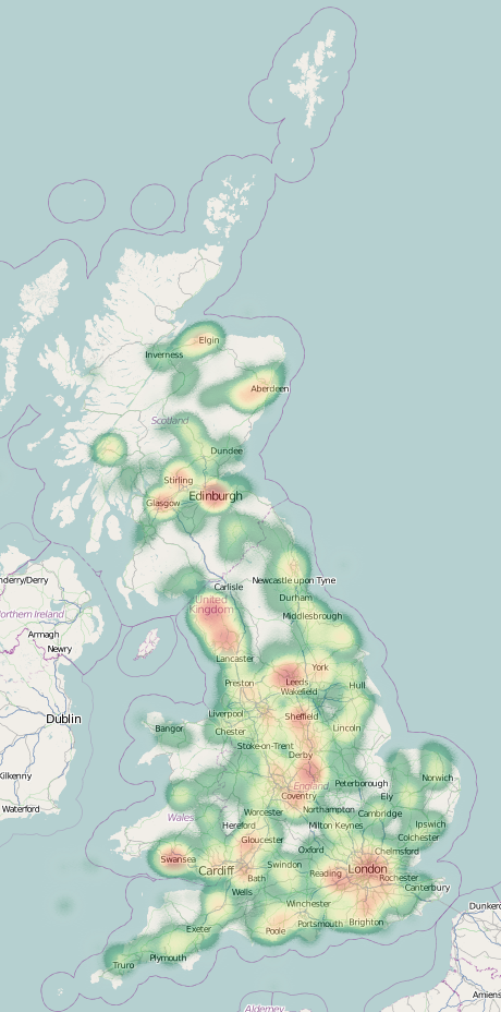
As you would expect, clusters appear around the main urban areas, where the population sizes supply participation for many local events being put on. Another major bright-spot is the Lake District, generally recognised to be the finest orienteering area in England. Other areas, such as the Cotswolds NW of Oxford, seem to be somewhat underused.
If you have a browser than can handle the HTML5 Canvas tag (i.e. not Internet Explorer!) you can view the heatmap here. Zoom into your local town or city to see if events have been held there – when zooming in, you’ll need to adjust the two sliders most of the way to the right, so that individual events show up. With the individual settings, a single, isolated event will have very little impact on the heatmap.
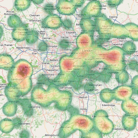
A look at the London area:
The heatmap was possible thanks to the excellent Heatmap library produced for OpenLayers by Bjoern Hoehrmann. The map is powered by OpenLayers, with an OpenStreetMap basemap. I’ve used a custom colour ramp, based on one supplied by Colorbrewer. The custom map adornments are supplied by MapBox.
2 replies on “Where in Britain are the Orienteering Races?”
[…] Cross-posted from my orienteering blog. […]
[…] This post was mentioned on Twitter by Ollie and Orienteered. Orienteered said: RT @ollesmaps: Heatmap of British orienteering races. http://fb.me/PgkYgYXD […]