Here’s what the Olympic Park in East London currently looks like on OpenStreetMap, following my recent tour and some other visual guestimating from outside the boundary fence:
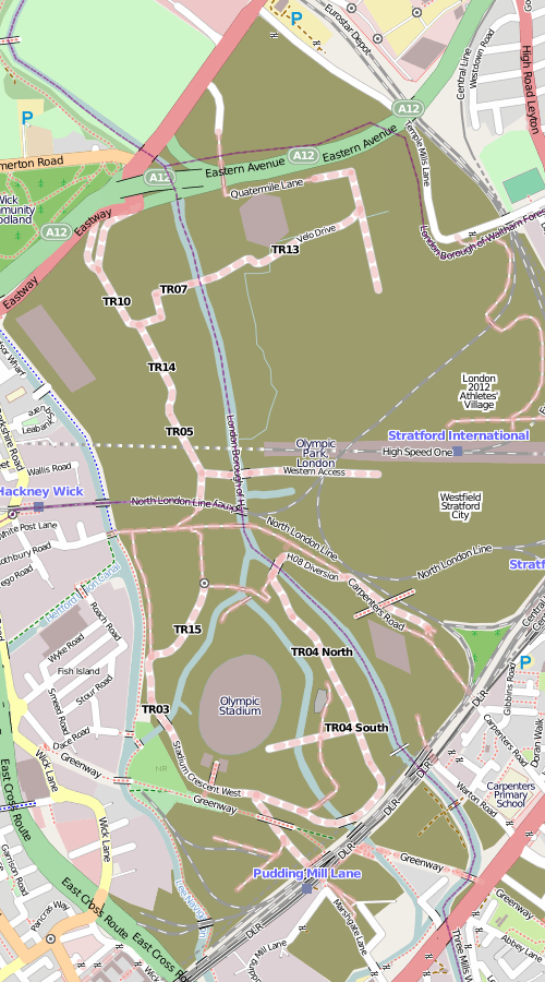
The brown areas shows the construction sites, most of which are for the Olympic Park, apart from the eastern area which is the Stratford City development and the southernmost area which is the Crossrail Pudding Mill Lane construction.
The main stadium is a rather unsteady oval, the media centre is the not-quite-rectangular building in the left-hand corner, the velodrome is the hexagon, and the aquatic centre is the diamond. These are all simplified shapes based on what I see, rather than any official plans. There aren’t any buildings yet for the athletes’ village (the fifth of the Big 5 permanent venues) or the Westfield Stratford City mega-development, just POIs. The roads are rather incomplete – although unlike the main venues, these might not be permanent. It’s about as complete as I can get it without privileged access to the site (unlikely) or tracing from detailed aerial or elevated imagery. There’s lots of such imagery out there – the official London 2012 blog has published quite a lot recently, as have some media.
So this is a plea to anyone owning such imagery – if they don’t mind it being used for OpenStreetMap data (i.e. happy to licence it under a Creative Commons Attribution licence) to let the OSM community use it for such purposes, so this high-profile site looks great and up-to-date on the map that everyone can use.
…or I could just wait until the park opens in two years time.