Instead of orienteering today, I organised a mapping party for UCL Geography. Three of us trekked out to Danbury, a historic village on a hill in Essex. Danbury lies just east of the extent of the high-resolution Yahoo aerial photography, so is almost completely unmapped. The village neatly splits into three main areas, so we each tackled one, by bike. After a couple of hours we retired to The Anchor pub for a late Sunday lunch – it was dark by the time we left, and very cold, so we skipped on mapping Little Baddow and headed back to upload the GPS data and add the topology to OpenStreetMap.
Here’s an automatically generated picture of our GPS traces for the day:
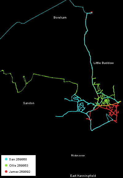
Here’s the Party Render animation, generated, like the picture above, from a very cool python script written by an OSMer:
My approach, from Chelmsford in the west and shown in green in the first picture above, was along National Cycle Route 1. As is often the case with the cycle network, it is not as direct as it could be.
The final result should appear on the main render on the OpenStreetMap website by Thursday.